
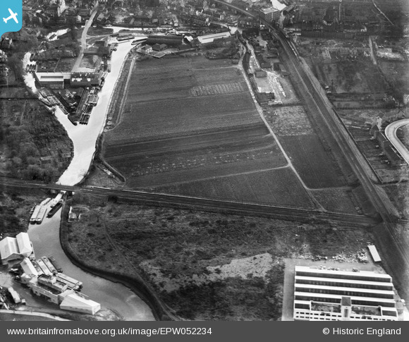
EPW052234 ENGLAND (1936). The site of the Brentford Business Centre on Commerce Road, Brentford, 1936
© Copyright OpenStreetMap contributors and licensed by the OpenStreetMap Foundation. 2026. Cartography is licensed as CC BY-SA.
Nearby Images (14)
EPW052234

EPW052240

EPW031244

EPW052236

EPW052239

EPW031243

EPW052235

EPW035096

EPW052237

EPW052238

EPW052233

EPW031240

EPW031241

EPW025230

Details
| Title | [EPW052234] The site of the Brentford Business Centre on Commerce Road, Brentford, 1936 |
| Reference | EPW052234 |
| Date | November-1936 |
| Link | |
| Place name | BRENTFORD |
| Parish | |
| District | |
| Country | ENGLAND |
| Easting / Northing | 517073, 177572 |
| Longitude / Latitude | -0.31373504851757, 51.484481990581 |
| National Grid Reference | TQ171776 |

