
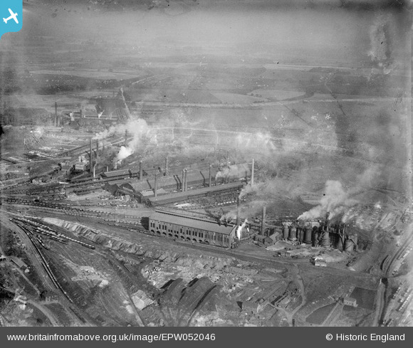
EPW052046 ENGLAND (1936). The Redbourn Hill Iron Works, Scunthorpe, from the west, 1936
© Copyright OpenStreetMap contributors and licensed by the OpenStreetMap Foundation. 2026. Cartography is licensed as CC BY-SA.
Nearby Images (7)
EPW052046

EPW049758

EPW052045

EPW049751

EPW049754

EPW049756

EPW049755

Details
| Title | [EPW052046] The Redbourn Hill Iron Works, Scunthorpe, from the west, 1936 |
| Reference | EPW052046 |
| Date | October-1936 |
| Link | |
| Place name | SCUNTHORPE |
| Parish | |
| District | |
| Country | ENGLAND |
| Easting / Northing | 491831, 411002 |
| Longitude / Latitude | -0.61257052052417, 53.587309148502 |
| National Grid Reference | SE918110 |
Pins

Peter Turvey |
Friday 24th of April 2015 05:53:25 PM |