
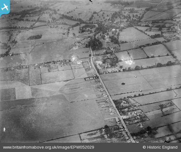
EPW052029 ENGLAND (1936). The junction of Holyport Road and Windsor Road prior to the construction of the Maidenhead by-pass, Bray Wick, from the south-east, 1936. This image has been produced from a damaged negative.
© Copyright OpenStreetMap contributors and licensed by the OpenStreetMap Foundation. 2026. Cartography is licensed as CC BY-SA.
Nearby Images (3)
EPW052029

EPW052020

EPW052021

Details
| Title | [EPW052029] The junction of Holyport Road and Windsor Road prior to the construction of the Maidenhead by-pass, Bray Wick, from the south-east, 1936. This image has been produced from a damaged negative. |
| Reference | EPW052029 |
| Date | October-1936 |
| Link | |
| Place name | BRAY WICK |
| Parish | BRAY |
| District | |
| Country | ENGLAND |
| Easting / Northing | 490618, 178183 |
| Longitude / Latitude | -0.6945017621004, 51.494834131873 |
| National Grid Reference | SU906782 |
Pins
Be the first to add a comment to this image!