
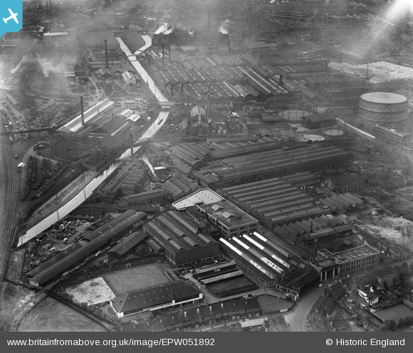
EPW051892 ENGLAND (1936). The W. and T. Avery Ltd Soho Foundry, Smethwick, 1936
© Copyright OpenStreetMap contributors and licensed by the OpenStreetMap Foundation. 2026. Cartography is licensed as CC BY-SA.
Nearby Images (21)
EPW051892

EPW051896

EPW051890

EPW051893

EPW051895

EPW051894

EPW051891

EAW001184

EPW053079

EAW001183

EPW053089

EPW053090

EPW053080

EPW053086

EPW051897

EAW001185

EPW020784

EPW020788

EPW020789

EPW036148

EPW036147

Details
| Title | [EPW051892] The W. and T. Avery Ltd Soho Foundry, Smethwick, 1936 |
| Reference | EPW051892 |
| Date | September-1936 |
| Link | |
| Place name | SMETHWICK |
| Parish | |
| District | |
| Country | ENGLAND |
| Easting / Northing | 403444, 288848 |
| Longitude / Latitude | -1.949264086933, 52.49715983666 |
| National Grid Reference | SP034888 |
Pins
 |

Class31 |
Thursday 27th of August 2015 08:55:19 PM |