
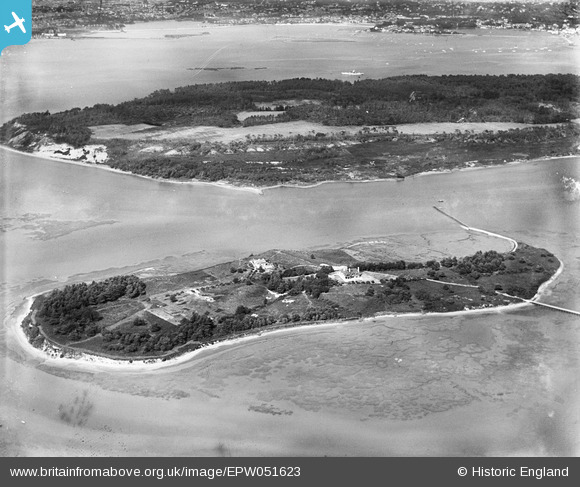
EPW051623 ENGLAND (1936). The island and Brownsea Island, Furzey Island, 1936
© Copyright OpenStreetMap contributors and licensed by the OpenStreetMap Foundation. 2026. Cartography is licensed as CC BY-SA.
Nearby Images (7)
EPW051623

EPW051627

EPW051629

EPW051625

EPW051626

EPW051620

EPW051624

Details
| Title | [EPW051623] The island and Brownsea Island, Furzey Island, 1936 |
| Reference | EPW051623 |
| Date | August-1936 |
| Link | |
| Place name | FURZEY ISLAND |
| Parish | CORFE CASTLE |
| District | |
| Country | ENGLAND |
| Easting / Northing | 401214, 87241 |
| Longitude / Latitude | -1.9828137871726, 50.684244827048 |
| National Grid Reference | SZ012872 |
Pins
Be the first to add a comment to this image!