
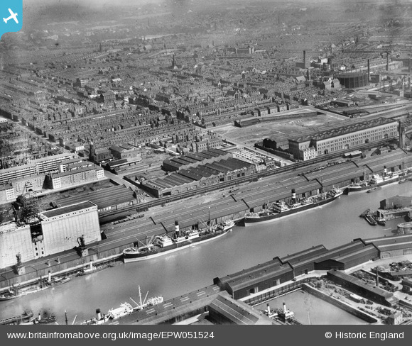
EPW051524 ENGLAND (1936). Brunswick Dock, the Goods Stations and environs, Liverpool, 1936
© Copyright OpenStreetMap contributors and licensed by the OpenStreetMap Foundation. 2026. Cartography is licensed as CC BY-SA.
Nearby Images (3)
EPW051524

EPR000321

EPW050660

Details
| Title | [EPW051524] Brunswick Dock, the Goods Stations and environs, Liverpool, 1936 |
| Reference | EPW051524 |
| Date | August-1936 |
| Link | |
| Place name | LIVERPOOL |
| Parish | |
| District | |
| Country | ENGLAND |
| Easting / Northing | 334962, 388388 |
| Longitude / Latitude | -2.9780184974835, 53.388059737248 |
| National Grid Reference | SJ350884 |
Pins

austin |
Tuesday 20th of July 2021 11:39:09 AM | |
|
davec |
Monday 3rd of August 2020 11:31:03 AM | |
|
davec |
Monday 3rd of August 2020 11:28:55 AM | |
|
davec |
Monday 3rd of August 2020 11:21:58 AM | |
|
davec |
Monday 3rd of August 2020 11:13:38 AM | |
|
davec |
Monday 3rd of August 2020 11:12:08 AM | |
|
davec |
Monday 3rd of August 2020 11:10:47 AM | |
|
oldliverpoolrailways |
Sunday 17th of January 2016 10:47:08 AM | |
|
Pete65 |
Friday 31st of May 2013 06:31:40 PM | |
|
Pete65 |
Friday 31st of May 2013 06:30:41 PM | |
|
Peter |
Sunday 5th of May 2013 04:34:27 PM |