
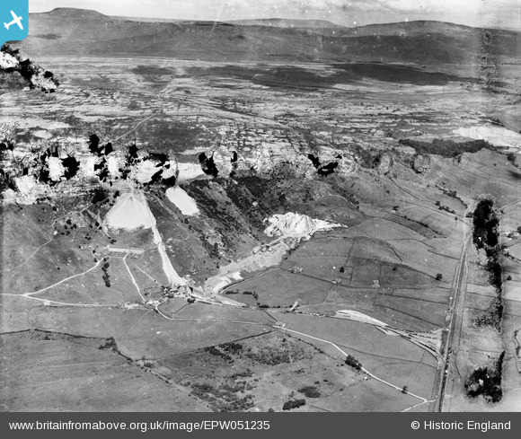
EPW051235 ENGLAND (1936). Ribblesdale Lime Works and surrounding quarries, Horton in Ribblesdale, from the south-east, 1936. This image has been produced from a damaged negative.
© Copyright OpenStreetMap contributors and licensed by the OpenStreetMap Foundation. 2026. Cartography is licensed as CC BY-SA.
Nearby Images (4)
EPW051235

EPW051233

EAW024199

EPW051231

Details
| Title | [EPW051235] Ribblesdale Lime Works and surrounding quarries, Horton in Ribblesdale, from the south-east, 1936. This image has been produced from a damaged negative. |
| Reference | EPW051235 |
| Date | July-1936 |
| Link | |
| Place name | HORTON IN RIBBLESDALE |
| Parish | HORTON IN RIBBLESDALE |
| District | |
| Country | ENGLAND |
| Easting / Northing | 380664, 470026 |
| Longitude / Latitude | -2.2959029718711, 54.125551567748 |
| National Grid Reference | SD807700 |
Pins
Be the first to add a comment to this image!