
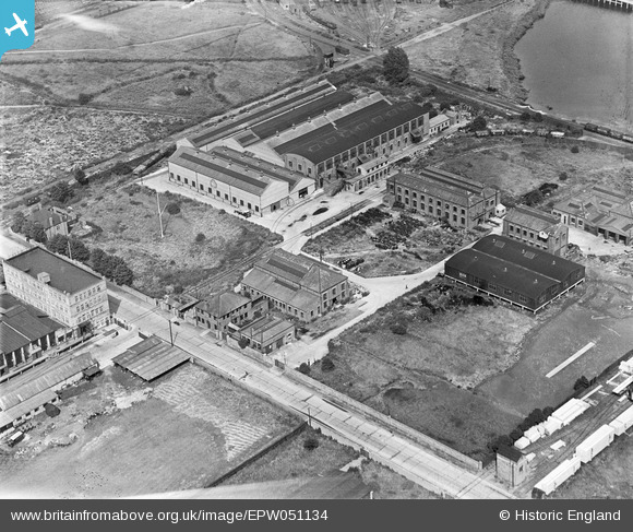
EPW051134 ENGLAND (1936). British Ropes Ltd, Dagenham, 1936
© Copyright OpenStreetMap contributors and licensed by the OpenStreetMap Foundation. 2026. Cartography is licensed as CC BY-SA.
Nearby Images (31)
EPW051134

EAW052709

EPW051133

EAW052712

EPW009960

EAW052707

EAW052706

EAW052710

EAW052713

EAW052708

EPW037318

EPW040938

EPW040939

EAW052711

EAW031619

EAW031622

EPW037319

EPW040935

EPW040933

EPW040937

EPW040934

EAW031764

EAW031625

EAW031757

EAW031765

EAW031620

EAW031618

EAW031758

EAW031762

EAW031763

EPW005330

Details
| Title | [EPW051134] British Ropes Ltd, Dagenham, 1936 |
| Reference | EPW051134 |
| Date | July-1936 |
| Link | |
| Place name | DAGENHAM |
| Parish | |
| District | |
| Country | ENGLAND |
| Easting / Northing | 549058, 182644 |
| Longitude / Latitude | 0.14879483159711, 51.522534071581 |
| National Grid Reference | TQ491826 |
Pins
Be the first to add a comment to this image!