
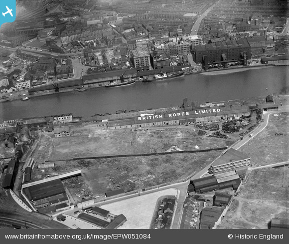
EPW051084 ENGLAND (1936). The British Ropes Ltd Wire Works, Gateshead, 1936
© Copyright OpenStreetMap contributors and licensed by the OpenStreetMap Foundation. 2026. Cartography is licensed as CC BY-SA.
Nearby Images (23)
EPW051084

EPW051085

EPW051089

EPW051087

EPW051086

EPW051088

EPW048807

EAW037008

EAW037012

EAW037017

EPW048234

EAW037013

EAW037018

EPW048232

EAW037009

EAW037010

EPW051090

EPW048801

EAW037011

EAW600907

EAW037016

EAW037014

EPW048818

Details
| Title | [EPW051084] The British Ropes Ltd Wire Works, Gateshead, 1936 |
| Reference | EPW051084 |
| Date | July-1936 |
| Link | |
| Place name | GATESHEAD |
| Parish | |
| District | |
| Country | ENGLAND |
| Easting / Northing | 425755, 563865 |
| Longitude / Latitude | -1.5976536035215, 54.968664526605 |
| National Grid Reference | NZ258639 |
Pins
Be the first to add a comment to this image!