
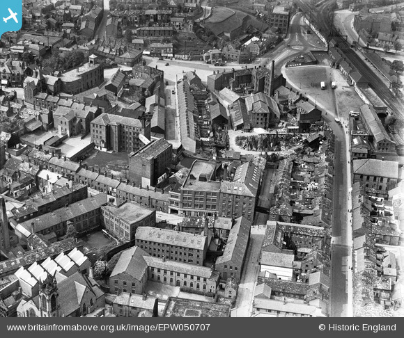
EPW050707 ENGLAND (1936). The Finishing Mill (Silk), the Marlborough Mill and the John Clayton Ltd Timber Yard, Macclesfield, 1936
© Copyright OpenStreetMap contributors and licensed by the OpenStreetMap Foundation. 2026. Cartography is licensed as CC BY-SA.
Nearby Images (18)
EPW050707
, the Marlborough Mill and the John Clayton Ltd Timber Yard, Macclesfield, 1936")
EPW050706
, the Marlborough Mill and the John Clayton Ltd Timber Yard, Macclesfield, 1936")
EPW050708
, the Marlborough Mill and the John Clayton Ltd Timber Yard, Macclesfield, 1936")
EPW050709
, the Marlborough Mill and the John Clayton Ltd Timber Yard, Macclesfield, 1936. This image has been affected by flare.")
EPW057641

EPW054379

EPW057635

EPW016745

EPW016741

EPW054374

EPW057374

EPW054376

EPW054380

EPW057643

EPW057639

EAW018063

EAW018061

EPW054378

Details
| Title | [EPW050707] The Finishing Mill (Silk), the Marlborough Mill and the John Clayton Ltd Timber Yard, Macclesfield, 1936 |
| Reference | EPW050707 |
| Date | June-1936 |
| Link | |
| Place name | MACCLESFIELD |
| Parish | |
| District | |
| Country | ENGLAND |
| Easting / Northing | 391860, 373442 |
| Longitude / Latitude | -2.1220321180745, 53.257642478416 |
| National Grid Reference | SJ919734 |
Pins
Be the first to add a comment to this image!