
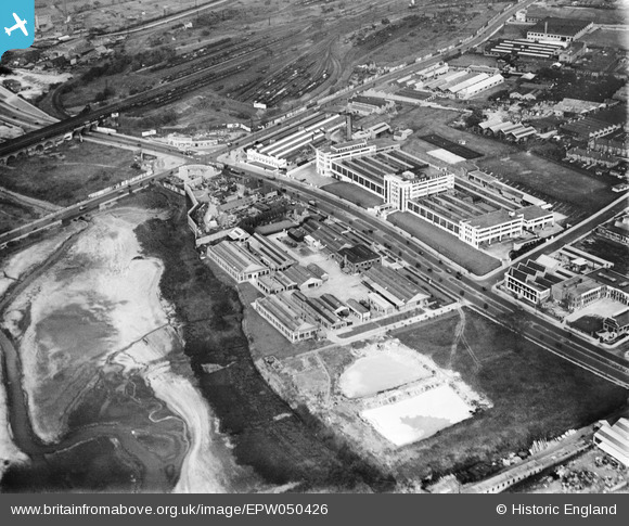
EPW050426 ENGLAND (1936). The Kemps Biscuit Factory on the North Circular Road and environs, Dollis Hill, 1936
© Copyright OpenStreetMap contributors and licensed by the OpenStreetMap Foundation. 2026. Cartography is licensed as CC BY-SA.
Nearby Images (38)
EPW050426

EAW048510

EPW020220

EPW032152

EPW032153

EPW032151

EAW048511

EPW020221

EAW048506

EPW050427

EAW048509

EPW032144

EAW048512

EAW048507

EAW048505

EPW055759

EAW048508

EPW032146

EPW055760

EPW038699

EPW046460

EPW057606

EPW032145

EAW004146

EAW004149

EPW050428

EAW004145

EPW046461

EAW004144

EAW004148

EPW032177

EPW053783

EAW004147

EPW032171

EPW053785

EPW032172

EPW038802

EPW040803

Details
| Title | [EPW050426] The Kemps Biscuit Factory on the North Circular Road and environs, Dollis Hill, 1936 |
| Reference | EPW050426 |
| Date | June-1936 |
| Link | |
| Place name | DOLLIS HILL |
| Parish | |
| District | |
| Country | ENGLAND |
| Easting / Northing | 522398, 187223 |
| Longitude / Latitude | -0.2337202139022, 51.570099500244 |
| National Grid Reference | TQ224872 |
Pins
Be the first to add a comment to this image!