
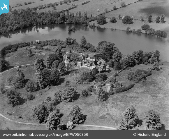
EPW050356 ENGLAND (1936). Willesley Hall and St Thomas's Church, Willesley, 1936
© Copyright OpenStreetMap contributors and licensed by the OpenStreetMap Foundation. 2026. Cartography is licensed as CC BY-SA.
Nearby Images (7)
EPW050356

EPW050342

EPW050357

EPW050346

EPW050344

EPW050351

EPW050358

Details
| Title | [EPW050356] Willesley Hall and St Thomas's Church, Willesley, 1936 |
| Reference | EPW050356 |
| Date | June-1936 |
| Link | |
| Place name | WILLESLEY |
| Parish | ASHBY-DE-LA-ZOUCH |
| District | |
| Country | ENGLAND |
| Easting / Northing | 434104, 314762 |
| Longitude / Latitude | -1.4949273467177, 52.729082950974 |
| National Grid Reference | SK341148 |
Pins
Be the first to add a comment to this image!
User Comment Contributions
Such a shame that a beautiful estate as this is now long gone |

smed smith |
Thursday 6th of March 2014 07:08:57 AM |