
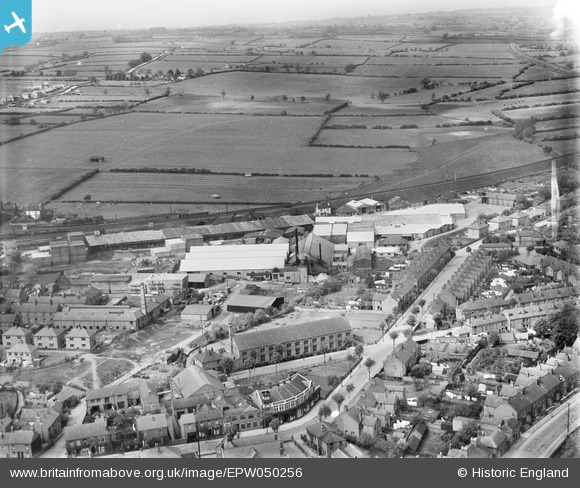
EPW050256 ENGLAND (1936). The Midland Woodworking Saw Mill and environs, Melton Mowbray, from the south, 1936
© Copyright OpenStreetMap contributors and licensed by the OpenStreetMap Foundation. 2026. Cartography is licensed as CC BY-SA.
Nearby Images (20)
EPW050256

EPW037856

EPW037860

EPW037861

EPW050264

EPW050258

EPW037857

EPW050257

EPW050262

EPW050261

EPW038042

EPW038045

EPW038044

EPW038043

EPW038041

EPW050259

EPW050260

EPW050263

EPW037859

EPW037858

Details
| Title | [EPW050256] The Midland Woodworking Saw Mill and environs, Melton Mowbray, from the south, 1936 |
| Reference | EPW050256 |
| Date | May-1936 |
| Link | |
| Place name | MELTON MOWBRAY |
| Parish | |
| District | |
| Country | ENGLAND |
| Easting / Northing | 475715, 319421 |
| Longitude / Latitude | -0.87769532738567, 52.76673721697 |
| National Grid Reference | SK757194 |
