
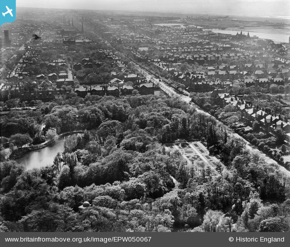
EPW050067 ENGLAND (1936). Hesketh Park, Albert Road (A565) and the surrounding residential area, Southport, from the north-east, 1936
© Copyright OpenStreetMap contributors and licensed by the OpenStreetMap Foundation. 2026. Cartography is licensed as CC BY-SA.
Nearby Images (4)
EPW050067
 and the surrounding residential area, Southport, from the north-east, 1936")
EPW050076

EPW050069
 and the surrounding residential area, Southport, 1936")
EPW050071

Details
| Title | [EPW050067] Hesketh Park, Albert Road (A565) and the surrounding residential area, Southport, from the north-east, 1936 |
| Reference | EPW050067 |
| Date | May-1936 |
| Link | |
| Place name | SOUTHPORT |
| Parish | |
| District | |
| Country | ENGLAND |
| Easting / Northing | 334766, 418264 |
| Longitude / Latitude | -2.9871892044693, 53.656564068023 |
| National Grid Reference | SD348183 |
Pins

Andrew |
Thursday 13th of August 2015 09:45:10 PM | |
|
Andrew |
Thursday 13th of August 2015 09:44:18 PM | |
|
Andrew |
Thursday 13th of August 2015 09:43:29 PM | |
|
Andrew |
Thursday 13th of August 2015 09:42:57 PM | |
|
Bryan |
Thursday 8th of May 2014 08:49:45 PM |