
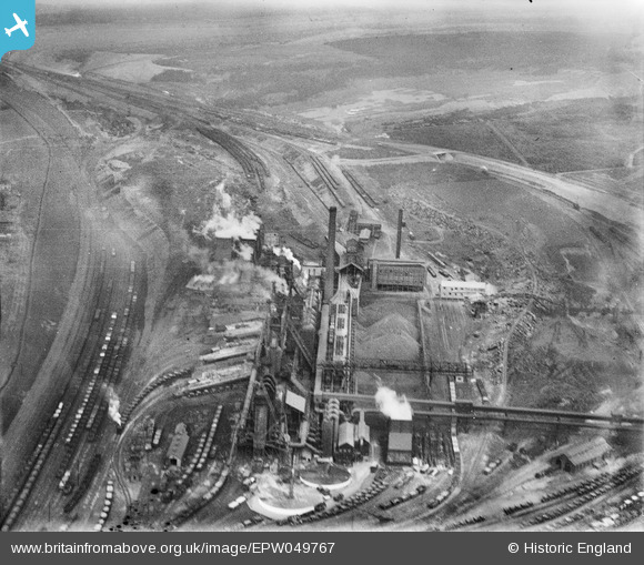
EPW049767 ENGLAND (1936). The Iron and Steel Works, Corby, 1936
© Copyright OpenStreetMap contributors and licensed by the OpenStreetMap Foundation. 2026. Cartography is licensed as CC BY-SA.
Nearby Images (20)
EPW049767

EPW054912

EPW049765

EAW045453

EPW054923

EAW045438

EAW034118

EAW034121

EAW034114

EAW034117

EAW034116

EPW054913

EAW034123

EAW034119

EAW034120

EPW049774

EAW034113

EPW049775

EAW034115

EPW049771

Details
| Title | [EPW049767] The Iron and Steel Works, Corby, 1936 |
| Reference | EPW049767 |
| Date | March-1936 |
| Link | |
| Place name | CORBY |
| Parish | |
| District | |
| Country | ENGLAND |
| Easting / Northing | 489679, 289635 |
| Longitude / Latitude | -0.67885598410674, 52.49687135293 |
| National Grid Reference | SP897896 |
Pins
Be the first to add a comment to this image!