
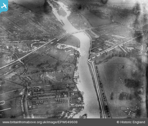
EPW049608 ENGLAND (1936). Hampton Court Palace, Ditton Field and environs, Thames Ditton, 1936
© Copyright OpenStreetMap contributors and licensed by the OpenStreetMap Foundation. 2026. Cartography is licensed as CC BY-SA.
Nearby Images (8)
EPW049608

EPW049573

EPW005055

EPW001712

EAW003680

EPW031566

EPW001713

EPR000449

Details
| Title | [EPW049608] Hampton Court Palace, Ditton Field and environs, Thames Ditton, 1936 |
| Reference | EPW049608 |
| Date | January-1936 |
| Link | |
| Place name | THAMES DITTON |
| Parish | |
| District | |
| Country | ENGLAND |
| Easting / Northing | 515710, 168031 |
| Longitude / Latitude | -0.33647761932616, 51.399000460108 |
| National Grid Reference | TQ157680 |
Pins

Ronald |
Sunday 16th of February 2014 01:01:47 PM | |
|
Ronald |
Sunday 16th of February 2014 12:56:59 PM | |
|
Ronald |
Sunday 16th of February 2014 12:55:27 PM | |
|
Ronald |
Friday 14th of February 2014 02:26:34 PM | |
|
Ronald |
Friday 14th of February 2014 02:24:13 PM | |
|
Pip |
Thursday 2nd of January 2014 04:23:45 PM | |
|
Pip |
Thursday 2nd of January 2014 04:23:20 PM | |
|
Pip |
Thursday 2nd of January 2014 04:22:58 PM |
User Comment Contributions

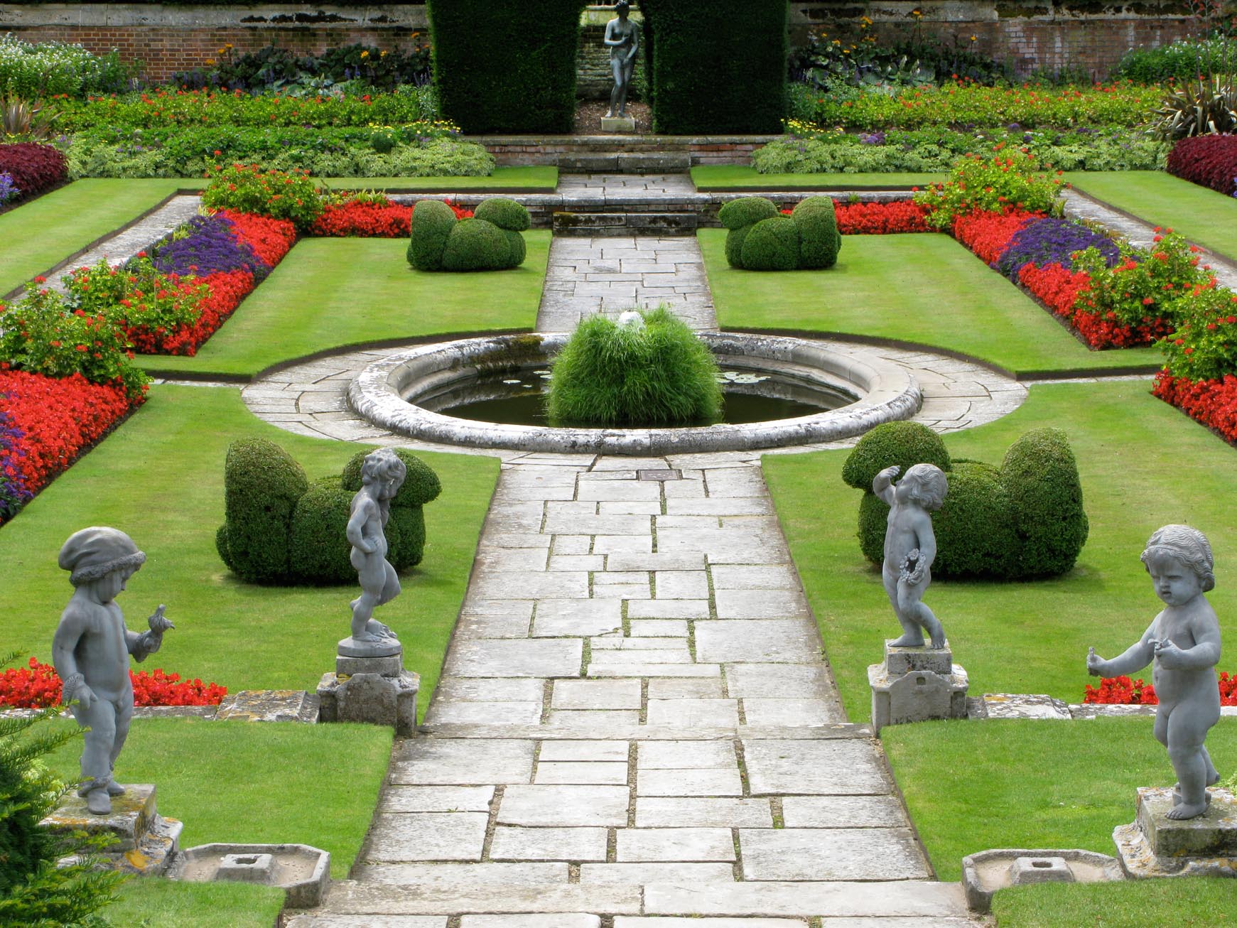
Hampton Court Palace Gardens |

Alan McFaden |
Monday 24th of November 2014 01:18:20 PM |
Hampton Court Palace Garden |
Alan McFaden |
Monday 24th of November 2014 01:17:52 PM |
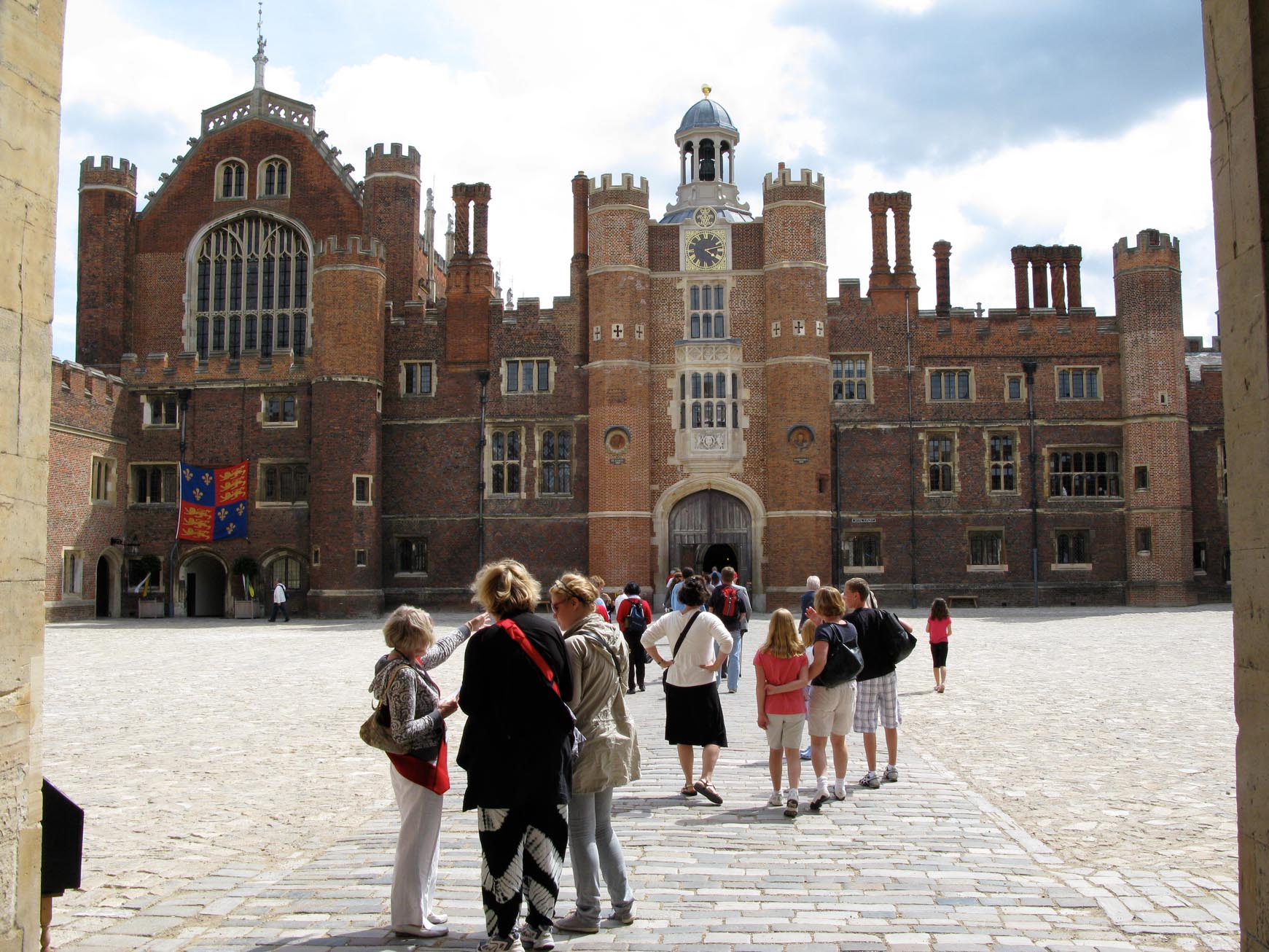
Hampton Court Palace |
Alan McFaden |
Monday 24th of November 2014 01:17:25 PM |
Taggs Island |
Ronald |
Sunday 16th of February 2014 01:04:42 PM |