
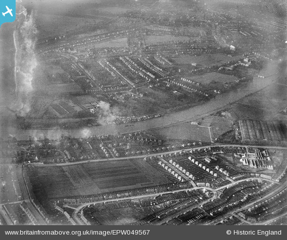
EPW049567 ENGLAND (1936). The River Thames at Teddington U.D. Council Sewage Works and environs, Hampton Wick, 1936. This image has been produced from a damaged negative.
© Copyright OpenStreetMap contributors and licensed by the OpenStreetMap Foundation. 2026. Cartography is licensed as CC BY-SA.
Nearby Images (2)
EPW049567

EPW049568

Details
| Title | [EPW049567] The River Thames at Teddington U.D. Council Sewage Works and environs, Hampton Wick, 1936. This image has been produced from a damaged negative. |
| Reference | EPW049567 |
| Date | January-1936 |
| Link | |
| Place name | HAMPTON WICK |
| Parish | |
| District | |
| Country | ENGLAND |
| Easting / Northing | 517627, 170895 |
| Longitude / Latitude | -0.30798010880199, 51.424349817169 |
| National Grid Reference | TQ176709 |
Pins

Marl |
Thursday 20th of June 2013 06:40:37 PM | |
|
Marl |
Thursday 20th of June 2013 06:39:18 PM | |
|
Marl |
Thursday 20th of June 2013 06:38:27 PM | |
|
Peter Heston |
Sunday 5th of May 2013 03:00:10 PM | |
|
Peter Heston |
Sunday 5th of May 2013 02:59:37 PM | |
|
Peter Heston |
Sunday 5th of May 2013 02:57:58 PM |
User Comment Contributions
Hampton Wick is off to the left of this photo. Ham Fields is the foreground. Exactly where were the supposed sewage works? |
Marl |
Thursday 20th of June 2013 06:37:15 PM |