
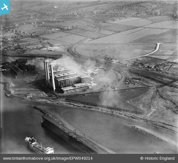
EPW049214 ENGLAND (1935). Dunston B Power Station and the West Dunston Coal Staithes, Dunston, 1935
© Copyright OpenStreetMap contributors and licensed by the OpenStreetMap Foundation. 2026. Cartography is licensed as CC BY-SA.
Nearby Images (5)
EPW049214

EPW049211

EPW049216

EPW049209

EPW049212

Details
| Title | [EPW049214] Dunston B Power Station and the West Dunston Coal Staithes, Dunston, 1935 |
| Reference | EPW049214 |
| Date | September-1935 |
| Link | |
| Place name | DUNSTON |
| Parish | |
| District | |
| Country | ENGLAND |
| Easting / Northing | 421762, 562909 |
| Longitude / Latitude | -1.6601037336944, 54.960263198526 |
| National Grid Reference | NZ218629 |
Pins
Be the first to add a comment to this image!