
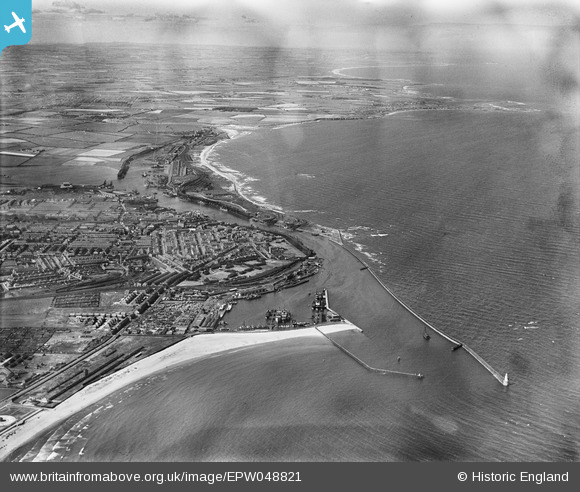
EPW048821 ENGLAND (1935). The harbour, town and countryside and coast to the north, Blyth, from the south, 1935
© Copyright OpenStreetMap contributors and licensed by the OpenStreetMap Foundation. 2026. Cartography is licensed as CC BY-SA.
Nearby Images (5)
EPW048821

EPW019751

EPW019753

EAW052312

EPW048836

Details
| Title | [EPW048821] The harbour, town and countryside and coast to the north, Blyth, from the south, 1935 |
| Reference | EPW048821 |
| Date | August-1935 |
| Link | |
| Place name | BLYTH |
| Parish | BLYTH |
| District | |
| Country | ENGLAND |
| Easting / Northing | 432223, 580714 |
| Longitude / Latitude | -1.4947115043347, 55.119706998409 |
| National Grid Reference | NZ322807 |
Pins
Be the first to add a comment to this image!
User Comment Contributions
THE GOOD TIMES IN BLYTH |

ED HINDHAUGH |
Friday 15th of November 2013 06:54:26 AM |
THE GOOD DAYS |
ED HINDHAUGH |
Friday 15th of November 2013 06:51:28 AM |