
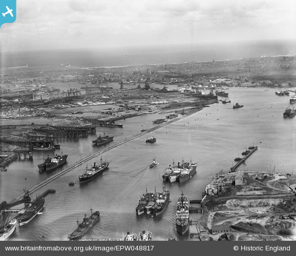
EPW048817 ENGLAND (1935). Northumberland Dock, the River Tyne and environs, East Howdon, from the south-west, 1935
© Copyright OpenStreetMap contributors and licensed by the OpenStreetMap Foundation. 2026. Cartography is licensed as CC BY-SA.
Nearby Images (3)
EPW048817

EAW050677

EAW050685

Details
| Title | [EPW048817] Northumberland Dock, the River Tyne and environs, East Howdon, from the south-west, 1935 |
| Reference | EPW048817 |
| Date | August-1935 |
| Link | |
| Place name | EAST HOWDON |
| Parish | |
| District | |
| Country | ENGLAND |
| Easting / Northing | 433763, 566045 |
| Longitude / Latitude | -1.4723004187943, 54.987777741619 |
| National Grid Reference | NZ338660 |
Pins
 |

N Dunn |
Thursday 9th of January 2014 01:43:33 PM |
 |
N Dunn |
Thursday 9th of January 2014 01:40:46 PM |
|
Eric Hollerton |
Sunday 28th of July 2013 06:23:29 PM | |
|
Eric Hollerton |
Sunday 28th of July 2013 06:22:31 PM | |

Dylan Moore |
Sunday 5th of May 2013 05:06:04 PM |