
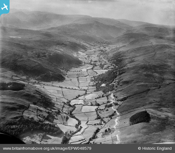
EPW048579 ENGLAND (1935). The valley, Longsleddale, from the south-east, 1935
© Copyright OpenStreetMap contributors and licensed by the OpenStreetMap Foundation. 2025. Cartography is licensed as CC BY-SA.
Nearby Images (6)
EPW048579

EPW041944

EPW041971

EPW041963

EPW041952

EPW041948

Details
| Title | [EPW048579] The valley, Longsleddale, from the south-east, 1935 |
| Reference | EPW048579 |
| Date | July-1935 |
| Link | |
| Place name | LONGSLEDDALE |
| Parish | LONGSLEDDALE |
| District | |
| Country | ENGLAND |
| Easting / Northing | 351078, 501208 |
| Longitude / Latitude | -2.7537291570179, 54.403836906491 |
| National Grid Reference | NY511012 |
Pins
Be the first to add a comment to this image!