
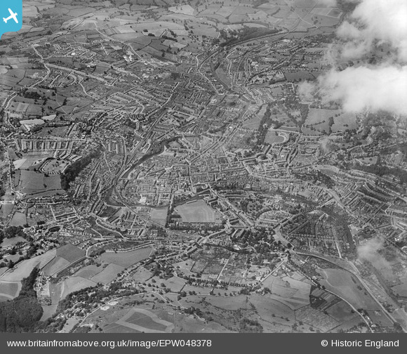
EPW048378 ENGLAND (1935). The city, Bath, from the north-east, 1935
© Copyright OpenStreetMap contributors and licensed by the OpenStreetMap Foundation. 2026. Cartography is licensed as CC BY-SA.
Nearby Images (5)
EPW048378

EPW048379

EPW001937

EAW023883

EPW001955

Details
| Title | [EPW048378] The city, Bath, from the north-east, 1935 |
| Reference | EPW048378 |
| Date | July-1935 |
| Link | |
| Place name | BATH |
| Parish | |
| District | |
| Country | ENGLAND |
| Easting / Northing | 375845, 164955 |
| Longitude / Latitude | -2.3471338370441, 51.382631449421 |
| National Grid Reference | ST758650 |
Pins

Class31 |
Saturday 18th of May 2013 08:15:11 PM |