
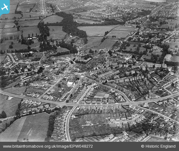
EPW048272 ENGLAND (1935). The suburb of Westbury-on-Trym, Bristol, 1935
© Copyright OpenStreetMap contributors and licensed by the OpenStreetMap Foundation. 2026. Cartography is licensed as CC BY-SA.
Nearby Images (3)
EPW048272

EPW048274

EPW048273

Details
| Title | [EPW048272] The suburb of Westbury-on-Trym, Bristol, 1935 |
| Reference | EPW048272 |
| Date | July-1935 |
| Link | |
| Place name | BRISTOL |
| Parish | |
| District | |
| Country | ENGLAND |
| Easting / Northing | 357202, 177301 |
| Longitude / Latitude | -2.6165339972515, 51.492547865149 |
| National Grid Reference | ST572773 |
Pins

gBr |
Tuesday 29th of December 2015 09:43:49 PM | |
|
gBr |
Wednesday 7th of October 2015 07:17:55 PM | |

Class31 |
Wednesday 16th of September 2015 07:51:37 AM | |
|
bristolian |
Wednesday 12th of November 2014 06:08:15 PM | |
|
bristolian |
Wednesday 12th of November 2014 05:52:52 PM | |
|
bristolian |
Wednesday 12th of November 2014 05:51:39 PM | |
|
Class31 |
Monday 9th of June 2014 10:02:20 AM | |
|
Class31 |
Monday 9th of June 2014 09:58:23 AM | |
|
Class31 |
Monday 9th of June 2014 09:53:04 AM |


