
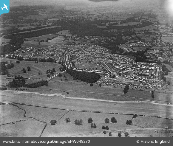
EPW048270 ENGLAND (1935). The residential area surrounding St Edyth's Road and Sylvan Way, Sea Mills, 1935
© Copyright OpenStreetMap contributors and licensed by the OpenStreetMap Foundation. 2025. Cartography is licensed as CC BY-SA.
Nearby Images (3)
EPW048270

EPW048269

EPW048271

Details
| Title | [EPW048270] The residential area surrounding St Edyth's Road and Sylvan Way, Sea Mills, 1935 |
| Reference | EPW048270 |
| Date | July-1935 |
| Link | |
| Place name | SEA MILLS |
| Parish | |
| District | |
| Country | ENGLAND |
| Easting / Northing | 354885, 176664 |
| Longitude / Latitude | -2.6498282554448, 51.486639806693 |
| National Grid Reference | ST549767 |
Pins

Donal Lucey |
Tuesday 4th of March 2025 06:12:21 PM | |
|
Geoff |
Tuesday 22nd of July 2014 04:12:25 PM | |
|
Geoff |
Tuesday 22nd of July 2014 04:10:37 PM | |
|
Geoff |
Tuesday 22nd of July 2014 04:09:33 PM | |
|
Geoff |
Tuesday 22nd of July 2014 04:09:02 PM | |
|
Geoff |
Tuesday 22nd of July 2014 04:08:12 PM | |
|
Geoff |
Tuesday 22nd of July 2014 04:07:32 PM |