
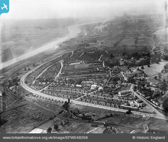
EPW048268 ENGLAND (1935). The residential area surrounding Portway and Park Road, Shirehampton, from the south-east, 1935
© Copyright OpenStreetMap contributors and licensed by the OpenStreetMap Foundation. 2025. Cartography is licensed as CC BY-SA.
Nearby Images (2)
EPW048268

EPW048265

Details
| Title | [EPW048268] The residential area surrounding Portway and Park Road, Shirehampton, from the south-east, 1935 |
| Reference | EPW048268 |
| Date | July-1935 |
| Link | |
| Place name | SHIREHAMPTON |
| Parish | |
| District | |
| Country | ENGLAND |
| Easting / Northing | 353284, 176633 |
| Longitude / Latitude | -2.6728829842037, 51.486231028432 |
| National Grid Reference | ST533766 |
Pins

Donal Lucey |
Tuesday 4th of March 2025 05:07:56 PM | |
|
Donal Lucey |
Tuesday 4th of March 2025 05:06:36 PM | |
|
Isleworth1961 |
Saturday 13th of December 2014 10:23:53 PM | |
|
Isleworth1961 |
Saturday 13th of December 2014 10:11:38 PM |