
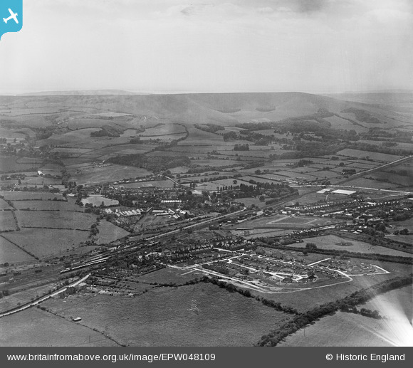
EPW048109 ENGLAND (1935). The town and surrounding countryside, Polegate, from the north-east, 1935
© Copyright OpenStreetMap contributors and licensed by the OpenStreetMap Foundation. 2026. Cartography is licensed as CC BY-SA.
Nearby Images (5)
EPW048109

 0°
0m
0°
0m
EPW048112
 65°
128m
65°
128m
EPW048113
 309°
145m
309°
145m
EPW048111
 278°
249m
278°
249m
EPW048107
 40°
275m
40°
275m
Details
| Title | [EPW048109] The town and surrounding countryside, Polegate, from the north-east, 1935 |
| Reference | EPW048109 |
| Date | July-1935 |
| Link | |
| Place name | POLEGATE |
| Parish | POLEGATE |
| District | |
| Country | ENGLAND |
| Easting / Northing | 558549, 104824 |
| Longitude / Latitude | 0.25117760725318, 50.820661779423 |
| National Grid Reference | TQ585048 |
 Wannock