
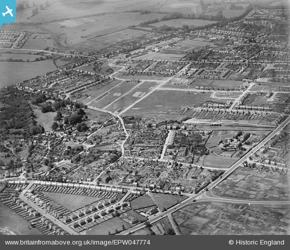
EPW047774 ENGLAND (1935). A housing estate under construction at New Headington, Oxford, from the north-east, 1935
© Copyright OpenStreetMap contributors and licensed by the OpenStreetMap Foundation. 2026. Cartography is licensed as CC BY-SA.
Nearby Images (5)
EPW047774

EPW047773

EAW003877

EPW047772

EPW047769

Details
| Title | [EPW047774] A housing estate under construction at New Headington, Oxford, from the north-east, 1935 |
| Reference | EPW047774 |
| Date | June-1935 |
| Link | |
| Place name | OXFORD |
| Parish | |
| District | |
| Country | ENGLAND |
| Easting / Northing | 455467, 207231 |
| Longitude / Latitude | -1.1962358733353, 51.760560214581 |
| National Grid Reference | SP555072 |
Pins

Avon Lady |
Saturday 20th of February 2021 09:28:31 PM | |
|
ndaisley |
Friday 13th of December 2019 11:22:34 AM | |
|
David Brimson |
Monday 16th of September 2019 07:45:30 PM | |
|
David Brimson |
Monday 16th of September 2019 07:18:50 PM | |
|
David Brimson |
Monday 16th of September 2019 07:18:01 PM | |
|
David Brimson |
Monday 16th of September 2019 07:16:49 PM | |
|
Sarah Jessop |
Tuesday 26th of January 2016 01:05:27 PM |