
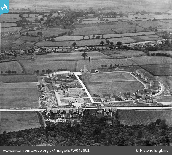
EPW047691 ENGLAND (1935). The Royal Eastern Counties Institution (Turner Village Hospital), Mile End, from the east, 1935
© Copyright OpenStreetMap contributors and licensed by the OpenStreetMap Foundation. 2025. Cartography is licensed as CC BY-SA.
Nearby Images (13)
EPW047691
, Mile End, from the east, 1935")
EPW047685
, Mile End, 1935")
EPW047695
, Mile End, 1935")
EPW047687
, Mile End, 1935")
EPW047688
, Mile End, 1935")
EPW047686
, Mile End, 1935")
EPW047689
, Mile End, 1935")
EPW047690
, Mile End, 1935")
EPW047693
, Mile End, 1935")
EPW047696
, Mile End, 1935")
EPW047694
, Mile End, 1935")
EPW047697
, Mile End, 1935")
EPW047692
, Mile End, 1935")
Details
| Title | [EPW047691] The Royal Eastern Counties Institution (Turner Village Hospital), Mile End, from the east, 1935 |
| Reference | EPW047691 |
| Date | June-1935 |
| Link | |
| Place name | MILE END |
| Parish | MYLAND |
| District | |
| Country | ENGLAND |
| Easting / Northing | 599704, 227149 |
| Longitude / Latitude | 0.90353018196786, 51.906587840508 |
| National Grid Reference | TL997271 |
Pins
Be the first to add a comment to this image!