
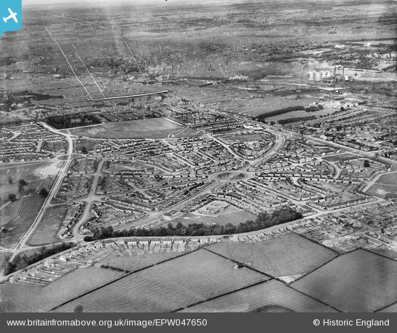
EPW047650 ENGLAND (1935). Housing development at Hallam Crescent East and Coalpit Lane, Braunstone Park, from the south-west, 1935. This image has been produced from a damaged negative.
© Copyright OpenStreetMap contributors and licensed by the OpenStreetMap Foundation. 2026. Cartography is licensed as CC BY-SA.
Nearby Images (3)
EPW047650

EPW047651

EPW047652

Details
| Title | [EPW047650] Housing development at Hallam Crescent East and Coalpit Lane, Braunstone Park, from the south-west, 1935. This image has been produced from a damaged negative. |
| Reference | EPW047650 |
| Date | June-1935 |
| Link | |
| Place name | BRAUNSTONE PARK |
| Parish | |
| District | |
| Country | ENGLAND |
| Easting / Northing | 456194, 302442 |
| Longitude / Latitude | -1.1699113551441, 52.616484706009 |
| National Grid Reference | SK562024 |
Pins
Be the first to add a comment to this image!