
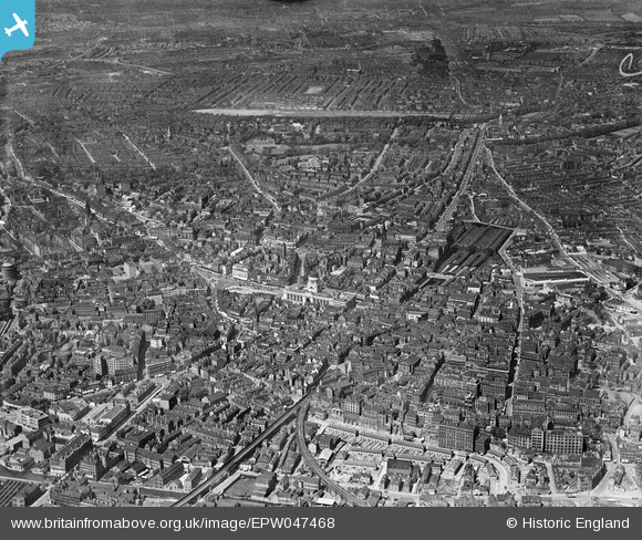
EPW047468 ENGLAND (1935). The Council House and the city centre, Nottingham, from the south-east, 1935
© Copyright OpenStreetMap contributors and licensed by the OpenStreetMap Foundation. 2026. Cartography is licensed as CC BY-SA.
Nearby Images (34)
EPW047468

EPW008583

EPW008490

EPW008493

EPW054989

EPW008491

EPW008489

EPW008492

EPW028871

EAW042516

EPW013014

EPW021793

EPW028869

EPW008488

EPW028001

EPW027999

EPW027998

EPW028002

EPW028000

EAW021699

EPW028872

EPW054996

EAW021697

EAW042515

EAW025941

EPW028873

EAW042517

EPW038634

EAW050486

EPW008487

EPW047469

EPW028870

EPW054993

EAW025940

Details
| Title | [EPW047468] The Council House and the city centre, Nottingham, from the south-east, 1935 |
| Reference | EPW047468 |
| Date | May-1935 |
| Link | |
| Place name | NOTTINGHAM |
| Parish | |
| District | |
| Country | ENGLAND |
| Easting / Northing | 457403, 339727 |
| Longitude / Latitude | -1.1455133851494, 52.951533691541 |
| National Grid Reference | SK574397 |
Pins

Tabbers |
Friday 14th of June 2024 08:58:20 PM | |
|
Guy |
Friday 29th of October 2021 05:42:25 PM | |
|
Sarah Manton |
Friday 16th of April 2021 08:00:01 AM | |
|
MG Nutt |
Monday 27th of January 2020 09:50:17 AM | |
|
John Wass |
Sunday 14th of June 2015 04:13:24 PM | |
|
John Wass |
Sunday 14th of June 2015 04:12:09 PM | |
|
David Morley |
Monday 4th of November 2013 11:51:55 PM | |
|
David Morley |
Monday 4th of November 2013 11:49:26 PM | |
Ex Great Central Railway's "London Extension". |
John Wass |
Sunday 14th of June 2015 04:10:51 PM |
|
David Morley |
Monday 4th of November 2013 11:43:38 PM | |
|
David Morley |
Monday 4th of November 2013 11:41:36 PM |