
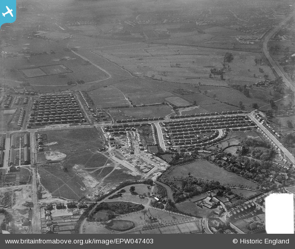
EPW047403 ENGLAND (1935). Light Oaks Park, housing under construction along Burnside Avenue and environs, Salford, from the east, 1935. This image was marked by Aerofilms Ltd for photo editing.
© Copyright OpenStreetMap contributors and licensed by the OpenStreetMap Foundation. 2026. Cartography is licensed as CC BY-SA.
Nearby Images (7)
EPW047403

EPW047407

EPW047408

EPW047406

EPW047411

EPW047404

EPW047473

Details
| Title | [EPW047403] Light Oaks Park, housing under construction along Burnside Avenue and environs, Salford, from the east, 1935. This image was marked by Aerofilms Ltd for photo editing. |
| Reference | EPW047403 |
| Date | May-1935 |
| Link | |
| Place name | SALFORD |
| Parish | |
| District | |
| Country | ENGLAND |
| Easting / Northing | 379151, 400125 |
| Longitude / Latitude | -2.3143202070103, 53.497162415858 |
| National Grid Reference | SD792001 |
Pins

I Sharratt |
Thursday 18th of April 2024 07:55:24 AM | |
|
I Sharratt |
Thursday 18th of April 2024 07:54:29 AM | |
|
I Sharratt |
Thursday 18th of April 2024 07:53:50 AM | |

Lizzie |
Tuesday 3rd of October 2023 08:20:45 PM | |
|
Lizzie |
Sunday 24th of September 2023 09:17:50 PM | |
|
I Sharratt |
Wednesday 9th of February 2022 06:25:26 AM | |
|
I Sharratt |
Wednesday 9th of February 2022 06:24:00 AM | |
|
I Sharratt |
Wednesday 12th of May 2021 01:26:50 AM |