
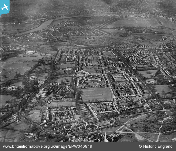
EPW046849 ENGLAND (1935). The residential area surrounding Huntingfield Road, Dover House Road and Putney Park Lane, Roehampton, 1935
© Copyright OpenStreetMap contributors and licensed by the OpenStreetMap Foundation. 2026. Cartography is licensed as CC BY-SA.
Nearby Images (5)
EPW046849

EPW046844

EPW046840

EPW046845

EPW046841

Details
| Title | [EPW046849] The residential area surrounding Huntingfield Road, Dover House Road and Putney Park Lane, Roehampton, 1935 |
| Reference | EPW046849 |
| Date | April-1935 |
| Link | |
| Place name | ROEHAMPTON |
| Parish | |
| District | |
| Country | ENGLAND |
| Easting / Northing | 522429, 174725 |
| Longitude / Latitude | -0.23761467782629, 51.457758030488 |
| National Grid Reference | TQ224747 |
Pins

charry |
Thursday 5th of February 2026 08:47:42 PM | |
|
charry |
Thursday 5th of February 2026 08:46:35 PM | |

Class31 |
Wednesday 9th of September 2015 03:45:16 PM | |
|
Class31 |
Wednesday 9th of September 2015 03:44:37 PM | |
|
Class31 |
Wednesday 9th of September 2015 03:43:59 PM | |
|
Class31 |
Wednesday 9th of September 2015 03:42:12 PM |


