
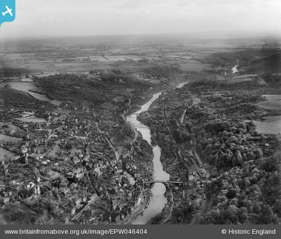
EPW046404 ENGLAND (1934). Ironbridge Gorge, Ironbridge, from the west, 1934
© Copyright OpenStreetMap contributors and licensed by the OpenStreetMap Foundation. 2026. Cartography is licensed as CC BY-SA.
Nearby Images (13)
EPW046404

EAW024219

EAW012586

EAW024220

EAW012671

EPW046406

EPW046402

EPW046398

EAW024221

EPW034286

EPW046395

EAW024217

EPW046401

Details
| Title | [EPW046404] Ironbridge Gorge, Ironbridge, from the west, 1934 |
| Reference | EPW046404 |
| Date | October-1934 |
| Link | |
| Place name | IRONBRIDGE |
| Parish | THE GORGE |
| District | |
| Country | ENGLAND |
| Easting / Northing | 367402, 303395 |
| Longitude / Latitude | -2.4816446497999, 52.626982099766 |
| National Grid Reference | SJ674034 |
Pins

LinconHouse |
Monday 16th of February 2026 09:45:06 PM | |

Alan McFaden |
Friday 12th of July 2013 11:02:03 AM | |
|
Alan McFaden |
Friday 12th of July 2013 11:01:05 AM |

