
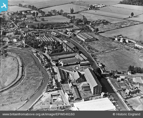
EPW046160 ENGLAND (1934). The E. H. Bentall and Co Works and environs, Heybridge, 1934
© Copyright OpenStreetMap contributors and licensed by the OpenStreetMap Foundation. 2026. Cartography is licensed as CC BY-SA.
Nearby Images (4)
EPW046160

EPW046159

EPW046154

EPW046158

Details
| Title | [EPW046160] The E. H. Bentall and Co Works and environs, Heybridge, 1934 |
| Reference | EPW046160 |
| Date | September-1934 |
| Link | |
| Place name | HEYBRIDGE |
| Parish | HEYBRIDGE |
| District | |
| Country | ENGLAND |
| Easting / Northing | 585645, 208061 |
| Longitude / Latitude | 0.68914226751868, 51.740001120482 |
| National Grid Reference | TL856081 |
Pins
Be the first to add a comment to this image!