
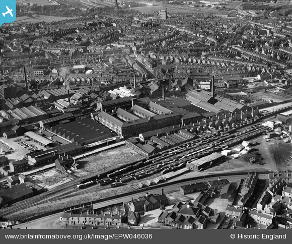
EPW046036 ENGLAND (1934). The British Timken Ltd Roller Bearing Works, Aston, 1934
© Copyright OpenStreetMap contributors and licensed by the OpenStreetMap Foundation. 2026. Cartography is licensed as CC BY-SA.
Nearby Images (26)
EPW046036

EPW061178

EAW045885

EAW045879

EAW045883

EPW046037

EAW045880

EPW046033

EAW045881

EAW045882

EAW045878

EPW046031

EAW045877

EAW045876

EPW046034

EPW046035

EPW061174

EPW061173

EPW061177

EPW061175

EPW061176

EAW045884

EAW045875

EPW061179

EPW046038

EPW046032

Details
| Title | [EPW046036] The British Timken Ltd Roller Bearing Works, Aston, 1934 |
| Reference | EPW046036 |
| Date | September-1934 |
| Link | |
| Place name | ASTON |
| Parish | |
| District | |
| Country | ENGLAND |
| Easting / Northing | 408546, 288991 |
| Longitude / Latitude | -1.8740995109599, 52.498389449836 |
| National Grid Reference | SP085890 |
Pins

Claire |
Thursday 20th of March 2025 12:52:51 PM |