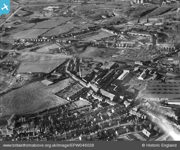
EPW046028 ENGLAND (1934). Brades Steel Works, Oldbury, 1934
© Copyright OpenStreetMap contributors and licensed by the OpenStreetMap Foundation. 2026. Cartography is licensed as CC BY-SA.
Nearby Images (13)
Details
| Title | [EPW046028] Brades Steel Works, Oldbury, 1934 |
| Reference | EPW046028 |
| Date | September-1934 |
| Link | |
| Place name | OLDBURY |
| Parish | |
| District | |
| Country | ENGLAND |
| Easting / Northing | 398180, 289850 |
| Longitude / Latitude | -2.02681714683, 52.506176631223 |
| National Grid Reference | SO982899 |
Pins
Be the first to add a comment to this image!


![[EPW046028] Brades Steel Works, Oldbury, 1934](http://britainfromabove.org.uk/sites/all/libraries/aerofilms-images/public/100x100/EPW/046/EPW046028.jpg)
![[EPW046026] Brades Steel Works, Oldbury, 1934](http://britainfromabove.org.uk/sites/all/libraries/aerofilms-images/public/100x100/EPW/046/EPW046026.jpg)
![[EPW046023] Brades Steel Works, Oldbury, 1934](http://britainfromabove.org.uk/sites/all/libraries/aerofilms-images/public/100x100/EPW/046/EPW046023.jpg)
![[EPW046022] Brades Steel Works, Oldbury, 1934](http://britainfromabove.org.uk/sites/all/libraries/aerofilms-images/public/100x100/EPW/046/EPW046022.jpg)
![[EPW046024] Brades Steel Works, Oldbury, 1934](http://britainfromabove.org.uk/sites/all/libraries/aerofilms-images/public/100x100/EPW/046/EPW046024.jpg)
![[EPW046025] Brades Steel Works, Oldbury, 1934](http://britainfromabove.org.uk/sites/all/libraries/aerofilms-images/public/100x100/EPW/046/EPW046025.jpg)
![[EPW046030] Brades Steel Works, Oldbury, 1934](http://britainfromabove.org.uk/sites/all/libraries/aerofilms-images/public/100x100/EPW/046/EPW046030.jpg)
![[EPW046027] Brades Steel Works and other factories alongside the Birmingham Canal, Oldbury, from the north-west, 1934](http://britainfromabove.org.uk/sites/all/libraries/aerofilms-images/public/100x100/EPW/046/EPW046027.jpg)
![[EPW046029] Brades Steel Works and other factories alongside the Birmingham Canal, Oldbury, from the north-west, 1934](http://britainfromabove.org.uk/sites/all/libraries/aerofilms-images/public/100x100/EPW/046/EPW046029.jpg)
![[EPW046086] Land between the Edwin Danks and Co Ltd Oldbury Boiler Works and Brades Bridge, Oldbury, 1934](http://britainfromabove.org.uk/sites/all/libraries/aerofilms-images/public/100x100/EPW/046/EPW046086.jpg)
![[EAW001215] Wolverhampton Road and the industrial and residential area at Round's Green, Oldbury, 1946](http://britainfromabove.org.uk/sites/all/libraries/aerofilms-images/public/100x100/EAW/001/EAW001215.jpg)
![[EPW046041] Accles and Pollock Ltd Paddock Tube Works, Oldbury, from the north-west, 1934](http://britainfromabove.org.uk/sites/all/libraries/aerofilms-images/public/100x100/EPW/046/EPW046041.jpg)
![[EPW046082] The Edwin Danks and Co Ltd Oldbury Boiler Works, Oldbury, 1934](http://britainfromabove.org.uk/sites/all/libraries/aerofilms-images/public/100x100/EPW/046/EPW046082.jpg)