
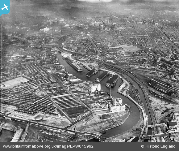
EPW045992 ENGLAND (1934). Pomona Docks, Salford, from the west, 1934
© Copyright OpenStreetMap contributors and licensed by the OpenStreetMap Foundation. 2026. Cartography is licensed as CC BY-SA.
Nearby Images (23)
EPW045992

EPW045071

EPW045070

EPW045065

EPW045069

EPW045066

EPW045067

EPW016773

EPW016772

EPW016777

EPW016775

EPW016774

EPW016771

EPW045068

EPW016770

EPW016776

EPW045983

EPW008985

EAW050415

EPW008988

EPW008989

EPW008990

EPW008987

Details
| Title | [EPW045992] Pomona Docks, Salford, from the west, 1934 |
| Reference | EPW045992 |
| Date | September-1934 |
| Link | |
| Place name | SALFORD |
| Parish | |
| District | |
| Country | ENGLAND |
| Easting / Northing | 381475, 396686 |
| Longitude / Latitude | -2.2790810364948, 53.466334921438 |
| National Grid Reference | SJ815967 |
Pins

John T. Pitman |
Saturday 7th of March 2015 12:19:27 AM | |
|
John T. Pitman |
Saturday 7th of March 2015 12:17:32 AM | |
|
John T. Pitman |
Saturday 7th of March 2015 12:16:13 AM | |
|
John T. Pitman |
Saturday 7th of March 2015 12:15:21 AM | |
|
John T. Pitman |
Saturday 7th of March 2015 12:14:27 AM | |
|
John T. Pitman |
Saturday 7th of March 2015 12:13:36 AM |