
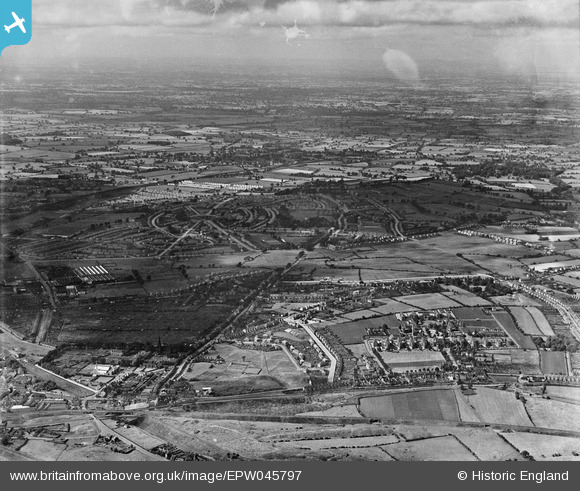
EPW045797 ENGLAND (1934). New housing development at Low Hill, New Cross Workhouse and Infirmary and environs, Heath Town, from the south-east, 1934
© Copyright OpenStreetMap contributors and licensed by the OpenStreetMap Foundation. 2026. Cartography is licensed as CC BY-SA.
Nearby Images (4)
EPW045797

EPW011776
, Wolverhampton, 1924. This image has been produced from a print.")
EPW045794

EPW045522

Details
| Title | [EPW045797] New housing development at Low Hill, New Cross Workhouse and Infirmary and environs, Heath Town, from the south-east, 1934 |
| Reference | EPW045797 |
| Date | August-1934 |
| Link | |
| Place name | HEATH TOWN |
| Parish | |
| District | |
| Country | ENGLAND |
| Easting / Northing | 393440, 299980 |
| Longitude / Latitude | -2.0968598635547, 52.597217867931 |
| National Grid Reference | SO9341000 |
Pins

John W |
Friday 10th of February 2017 07:10:19 PM | |
|
John W |
Friday 10th of February 2017 07:07:51 PM | |
|
John W |
Friday 10th of February 2017 07:07:03 PM |