
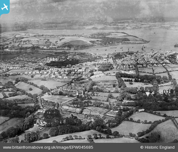
EPW045685 ENGLAND (1934). Residential area at Swanvale and the town, Falmouth, from the south-west, 1934
© Copyright OpenStreetMap contributors and licensed by the OpenStreetMap Foundation. 2026. Cartography is licensed as CC BY-SA.
Nearby Images (4)
EPW045685

 0°
0m
0°
0m
EPW045682
 27°
148m
27°
148m
EPW045684
 40°
222m
40°
222m
EPW045683
 44°
264m
44°
264m
Details
| Title | [EPW045685] Residential area at Swanvale and the town, Falmouth, from the south-west, 1934 |
| Reference | EPW045685 |
| Date | July-1934 |
| Link | |
| Place name | FALMOUTH |
| Parish | FALMOUTH |
| District | |
| Country | ENGLAND |
| Easting / Northing | 179677, 32001 |
| Longitude / Latitude | -5.0841942119947, 50.146445158113 |
| National Grid Reference | SW797320 |
Pins
 Penmere Platform Station which opened on 1 July 1925. Penmere Platform Station which opened on 1 July 1925. |

Class31 |
Thursday 15th of May 2014 11:14:39 AM |