
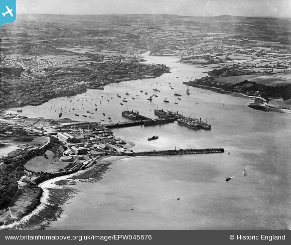
EPW045676 ENGLAND (1934). Boats moored in the Outer and Inner Harbours and the mouth of the Penryn River, Falmouth, from the south-east, 1934
© Copyright OpenStreetMap contributors and licensed by the OpenStreetMap Foundation. 2026. Cartography is licensed as CC BY-SA.
Nearby Images (4)
EPW045676

EPW023351

EAW021381

EPW023370

Details
| Title | [EPW045676] Boats moored in the Outer and Inner Harbours and the mouth of the Penryn River, Falmouth, from the south-east, 1934 |
| Reference | EPW045676 |
| Date | July-1934 |
| Link | |
| Place name | FALMOUTH |
| Parish | FALMOUTH |
| District | |
| Country | ENGLAND |
| Easting / Northing | 182337, 32605 |
| Longitude / Latitude | -5.0473593911768, 50.152852483812 |
| National Grid Reference | SW823326 |
Pins
Be the first to add a comment to this image!