
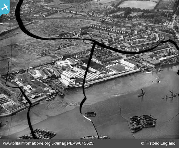
EPW045625 ENGLAND (1934). The British Fibrocement Works, Erith, 1934. This image has been produced from a damaged negative.
© Copyright OpenStreetMap contributors and licensed by the OpenStreetMap Foundation. 2026. Cartography is licensed as CC BY-SA.
Nearby Images (17)
EPW045625

EPW060434

EPW045622

EPW045628

EPW045627

EPW045626

EPW045624

EPW060444

EPW060437

EPW060438

EPW060441

EPW060442

EPW060446

EPW060439

EPW060436

EPW060440

EPW060443

Details
| Title | [EPW045625] The British Fibrocement Works, Erith, 1934. This image has been produced from a damaged negative. |
| Reference | EPW045625 |
| Date | July-1934 |
| Link | |
| Place name | ERITH |
| Parish | |
| District | |
| Country | ENGLAND |
| Easting / Northing | 552073, 177873 |
| Longitude / Latitude | 0.19016776916454, 51.478858366033 |
| National Grid Reference | TQ521779 |
Pins
Be the first to add a comment to this image!