
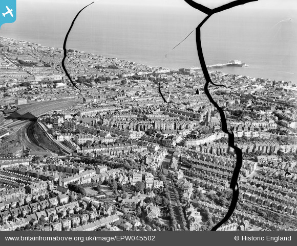
EPW045502 ENGLAND (1934). Central station and the town centre looking across to the Palace Pier, Brighton, from the north-west, 1934. This image has been produced from a damaged negative.
© Copyright OpenStreetMap contributors and licensed by the OpenStreetMap Foundation. 2026. Cartography is licensed as CC BY-SA.
Nearby Images (2)
EPW045502

EPW011489

Details
| Title | [EPW045502] Central station and the town centre looking across to the Palace Pier, Brighton, from the north-west, 1934. This image has been produced from a damaged negative. |
| Reference | EPW045502 |
| Date | July-1934 |
| Link | |
| Place name | BRIGHTON |
| Parish | |
| District | |
| Country | ENGLAND |
| Easting / Northing | 530593, 105157 |
| Longitude / Latitude | -0.14539468564187, 50.830636836105 |
| National Grid Reference | TQ306052 |
Pins

Gareth |
Friday 29th of August 2025 11:24:04 AM | |
|
mannidaze |
Wednesday 5th of June 2019 07:30:32 PM | |

Alan McFaden |
Friday 12th of July 2013 06:34:23 PM | |
|
Alan McFaden |
Friday 12th of July 2013 06:29:48 PM | |
|
Alan McFaden |
Friday 12th of July 2013 06:25:35 PM | |
|
Alan McFaden |
Friday 12th of July 2013 06:24:05 PM | |
|
Alan McFaden |
Friday 12th of July 2013 06:23:09 PM | |
|
Alan McFaden |
Friday 12th of July 2013 06:21:23 PM | |
|
Alan McFaden |
Friday 12th of July 2013 06:18:32 PM | |
|
Alan McFaden |
Friday 12th of July 2013 06:17:39 PM | |
|
Alan McFaden |
Friday 12th of July 2013 06:16:56 PM |


