
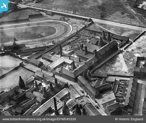
EPW045339 ENGLAND (1934). The Fairfield Pottery and the Vulcan Pottery alongside Slippery Lane, Hanley, 1934
© Copyright OpenStreetMap contributors and licensed by the OpenStreetMap Foundation. 2026. Cartography is licensed as CC BY-SA.
Nearby Images (6)
EPW045339

EPW045338

EPW045336

EPW045335

EPW045337

EPW047683

Details
| Title | [EPW045339] The Fairfield Pottery and the Vulcan Pottery alongside Slippery Lane, Hanley, 1934 |
| Reference | EPW045339 |
| Date | July-1934 |
| Link | |
| Place name | HANLEY |
| Parish | |
| District | |
| Country | ENGLAND |
| Easting / Northing | 387833, 347200 |
| Longitude / Latitude | -2.1814066594958, 53.021650858162 |
| National Grid Reference | SJ878472 |
Pins

bescotbeast |
Tuesday 4th of March 2014 12:50:42 AM | |
|
bescotbeast |
Tuesday 4th of March 2014 12:46:18 AM | |
|
bescotbeast |
Tuesday 4th of March 2014 12:44:18 AM | |

gbaddley |
Thursday 7th of November 2013 07:45:14 PM | |
Interesting titbit, thanks for sharing |
bescotbeast |
Tuesday 4th of March 2014 12:43:46 AM |