
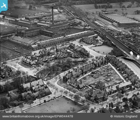
EPW044478 ENGLAND (1934). The Lever Brothers Sunlight Soap Works and housing at Park Road, Port Sunlight, 1934
© Copyright OpenStreetMap contributors and licensed by the OpenStreetMap Foundation. 2026. Cartography is licensed as CC BY-SA.
Nearby Images (4)
EPW044478

EPW044476

EPW044477

EAW000418

Details
| Title | [EPW044478] The Lever Brothers Sunlight Soap Works and housing at Park Road, Port Sunlight, 1934 |
| Reference | EPW044478 |
| Date | May-1934 |
| Link | |
| Place name | PORT SUNLIGHT |
| Parish | |
| District | |
| Country | ENGLAND |
| Easting / Northing | 333744, 384075 |
| Longitude / Latitude | -2.9954271595265, 53.349141773519 |
| National Grid Reference | SJ337841 |
Pins

John Llewellyn |
Saturday 9th of July 2016 05:13:04 PM | |
|
bri445 |
Sunday 26th of January 2014 12:43:42 PM | |
|
bri445 |
Sunday 26th of January 2014 11:21:44 AM | |
|
bri445 |
Sunday 26th of January 2014 11:04:38 AM | |
|
bri445 |
Sunday 26th of January 2014 11:03:29 AM | |
|
beast66606 |
Monday 20th of January 2014 10:18:52 PM | |
|
Pete65 |
Monday 14th of October 2013 11:17:36 AM | |
|
Pete65 |
Monday 14th of October 2013 11:16:56 AM |