
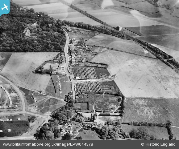
EPW044378 ENGLAND (1934). Hurst Road and environs, Bexley Woods, 1934
© Copyright OpenStreetMap contributors and licensed by the OpenStreetMap Foundation. 2026. Cartography is licensed as CC BY-SA.
Nearby Images (11)
EPW044378

EPW044379

EPW044377

EPW044736

EPW044735

EPW044734

EPW044376

EPW044733

EPW044732

EPW044718

EPW044719

Details
| Title | [EPW044378] Hurst Road and environs, Bexley Woods, 1934 |
| Reference | EPW044378 |
| Date | May-1934 |
| Link | |
| Place name | BEXLEY WOODS |
| Parish | |
| District | |
| Country | ENGLAND |
| Easting / Northing | 548024, 173134 |
| Longitude / Latitude | 0.12991378130859, 51.437346276033 |
| National Grid Reference | TQ480731 |
Pins
Be the first to add a comment to this image!