
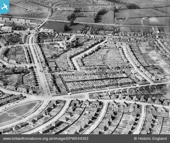
EPW044362 ENGLAND (1934). Wellington Avenue, Penhurst Avenue, Burns Avenue and environs, Blackfen, 1934
© Copyright OpenStreetMap contributors and licensed by the OpenStreetMap Foundation. 2026. Cartography is licensed as CC BY-SA.
Nearby Images (7)
EPW044362

EPW044360

EPW044361

EPW038436

EPW038438

EPW038435

EPW038433

Details
| Title | [EPW044362] Wellington Avenue, Penhurst Avenue, Burns Avenue and environs, Blackfen, 1934 |
| Reference | EPW044362 |
| Date | May-1934 |
| Link | |
| Place name | BLACKFEN |
| Parish | |
| District | |
| Country | ENGLAND |
| Easting / Northing | 546405, 174120 |
| Longitude / Latitude | 0.10704293235918, 51.446627761161 |
| National Grid Reference | TQ464741 |
Pins

currantbun |
Wednesday 7th of May 2014 07:12:18 PM |