
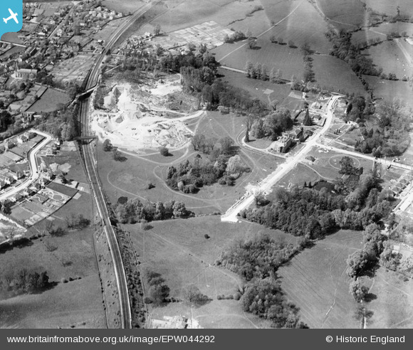
EPW044292 ENGLAND (1934). Construction of housing on Robyns Way and the Tonbridge Main Railway Line, Sevenoaks, 1934
© Copyright OpenStreetMap contributors and licensed by the OpenStreetMap Foundation. 2026. Cartography is licensed as CC BY-SA.
Nearby Images (5)
EPW044292

EPW044293

EPW044295

EPW044294

EPW044296

Details
| Title | [EPW044292] Construction of housing on Robyns Way and the Tonbridge Main Railway Line, Sevenoaks, 1934 |
| Reference | EPW044292 |
| Date | May-1934 |
| Link | |
| Place name | SEVENOAKS |
| Parish | SEVENOAKS |
| District | |
| Country | ENGLAND |
| Easting / Northing | 551892, 156042 |
| Longitude / Latitude | 0.17822671244093, 51.282730188545 |
| National Grid Reference | TQ519560 |
