
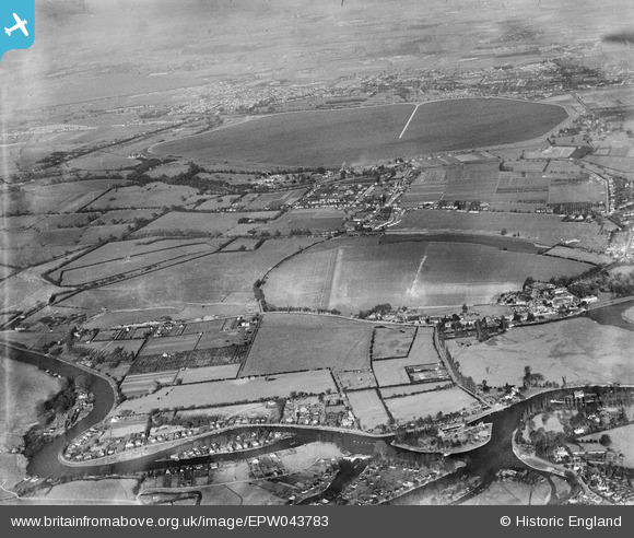
EPW043783 ENGLAND (1934). Shepperton, Littleton and the Queen Mary Reservoir, Shepperton, from the south, 1934
© Copyright OpenStreetMap contributors and licensed by the OpenStreetMap Foundation. 2025. Cartography is licensed as CC BY-SA.
Nearby Images (4)
EPW043783

EPW043781

EPW043782

EPW043780

Details
| Title | [EPW043783] Shepperton, Littleton and the Queen Mary Reservoir, Shepperton, from the south, 1934 |
| Reference | EPW043783 |
| Date | February-1934 |
| Link | |
| Place name | SHEPPERTON |
| Parish | |
| District | |
| Country | ENGLAND |
| Easting / Northing | 507049, 166518 |
| Longitude / Latitude | -0.46139998992447, 51.387100393228 |
| National Grid Reference | TQ070665 |
Pins
 bumblee |
Sunday 22nd of May 2016 12:30:09 PM | |
bumblee |
Thursday 5th of February 2015 10:33:33 AM | |
bumblee |
Thursday 5th of February 2015 10:32:38 AM | |
bumblee |
Wednesday 1st of October 2014 03:42:50 PM | |
mpg |
Sunday 10th of August 2014 10:35:27 PM |