
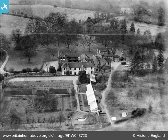
EPW043720 ENGLAND (1934). Gifford's Hall, Withermarsh Green, 1934
© Copyright OpenStreetMap contributors and licensed by the OpenStreetMap Foundation. 2026. Cartography is licensed as CC BY-SA.
Nearby Images (22)
EPW043720

EPW043721

EPW043703

EAW036742

EPW043698

EPW043702

EPW043697

EPW043701

EAW036743

EAW036741

EPW043718

EAW036744

EAW036739

EPW043722

EPW043724

EPW043717

EPW043719

EPW043700

EPW043723

EPW043699

EAW036740

EAW036745

Details
| Title | [EPW043720] Gifford's Hall, Withermarsh Green, 1934 |
| Reference | EPW043720 |
| Date | January-1934 |
| Link | |
| Place name | WITHERMARSH GREEN |
| Parish | STOKE-BY-NAYLAND |
| District | |
| Country | ENGLAND |
| Easting / Northing | 601819, 237428 |
| Longitude / Latitude | 0.94027336754557, 51.998130997094 |
| National Grid Reference | TM018374 |
Pins

totoro |
Tuesday 3rd of December 2013 06:16:27 PM |