
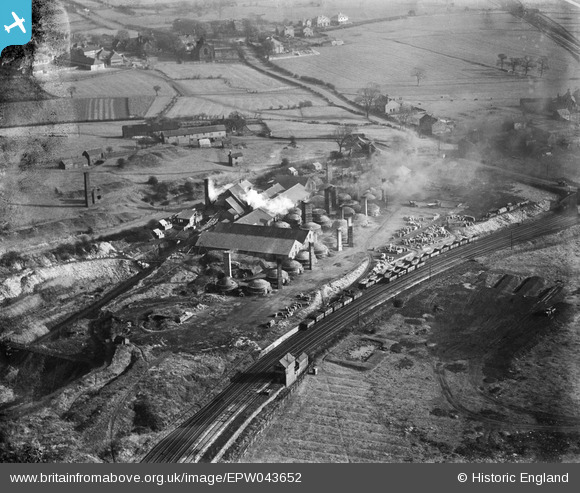
EPW043652 ENGLAND (1933). Knutton Tileries, Newcastle-under-Lyme, 1933
© Copyright OpenStreetMap contributors and licensed by the OpenStreetMap Foundation. 2026. Cartography is licensed as CC BY-SA.
Nearby Images (11)
EPW043652

EPW038476

EPW038480

EPW038481

EPW027807

EPW027808

EPW043654

EPW043655

EPW038478

EPW038477

EPW043656

Details
| Title | [EPW043652] Knutton Tileries, Newcastle-under-Lyme, 1933 |
| Reference | EPW043652 |
| Date | November-1933 |
| Link | |
| Place name | NEWCASTLE-UNDER-LYME |
| Parish | SILVERDALE |
| District | |
| Country | ENGLAND |
| Easting / Northing | 382995, 346651 |
| Longitude / Latitude | -2.2535103297907, 53.016583410215 |
| National Grid Reference | SJ830467 |
Pins

bescotbeast |
Saturday 1st of March 2014 02:31:23 AM | |

Muso |
Friday 14th of June 2013 09:56:52 PM |
User Comment Contributions
Ketley Sidings signal box, NSR Type 2 design. Controlled access to the Pool Dam branch once Knutton Forge Junction signal box had closed. |
bescotbeast |
Saturday 1st of March 2014 02:32:20 AM |